Distance Calculator: Find Exact Measurements Between Any Two Points
Measuring distances accurately is essential in countless situations - from planning road trips and hiking routes to designing floor plans and completing school projects. The Distance Calculator makes this process simple, quick, and error-free by instantly calculating the straight-line distance between any two points.
Whether you're a student working on geometry homework, a traveler planning routes, a homeowner designing a garden layout, or a professional needing precise measurements, this tool provides reliable results in various units. No more manual calculations or guesswork - get accurate distances in seconds.
Practical applications of distance calculations:
- Travel Planning: Estimate driving, walking, or flying distances between locations
- Home Projects: Plan garden layouts, furniture placement, or room dimensions
- Academic Work: Complete geometry assignments, physics problems, or geography projects
- Sports & Fitness: Measure running routes, cycling paths, or field dimensions
- Real Estate: Calculate property boundaries, lot sizes, or neighborhood distances
Our distance calculator provides instant, accurate results. For other geometric calculations, check our Geometry Calculators collection.
Real-Life Distance Calculation Scenarios
Sarah's Road Trip Planning
Sarah planned a road trip from Chicago to Nashville and wanted to calculate the exact driving distance to estimate fuel costs and travel time. She used coordinates for both cities to get the straight-line distance, then adjusted for actual road routes.
Road Trip Analysis:
- Chicago coordinates: 41.8781° N, 87.6298° W
- Nashville coordinates: 36.1627° N, 86.7816° W
- Straight-line distance: Approximately 470 miles (756 km)
- Actual driving distance (roads): ~475 miles (764 km)
- Driving time estimate: 7-8 hours (depending on traffic)
- Fuel calculation: 475 miles ÷ 25 MPG = 19 gallons needed
- Fuel cost: 19 gallons × $3.50/gallon = $66.50 (one way)
- Planning benefit: Accurate budget and schedule planning
By calculating the distance accurately, Sarah could budget properly for fuel, plan rest stops, and estimate arrival time.
Mike's Garden Layout Design
Mike designed a new vegetable garden in his backyard and needed to calculate distances between planting beds, paths, and irrigation points to optimize space and efficiency.
Garden Planning Analysis:
- Garden area: 30 feet × 40 feet rectangle
- Bed 1 to Bed 2 distance: 8 feet apart (optimal for plant growth)
- Path width: 3 feet between beds (comfortable walking space)
- Water source to farthest bed: 25 feet (determines hose length needed)
- Total path length: 85 linear feet (calculates mulch/gravel needed)
- Space utilization: 65% planting area, 35% paths/access
- Design benefit: Efficient layout maximizing growing space
Precise distance calculations helped Mike create an efficient garden layout that was both productive and easy to maintain.
For area calculations in gardening, try our Square Feet Area Calculator.
Robert's Home Renovation Project
Robert planned to install new flooring throughout his home and needed to calculate diagonal distances for cutting boards efficiently and minimizing waste.
Flooring Installation Analysis:
- Room dimensions: 15 feet × 20 feet
- Diagonal distance: √(15² + 20²) = √(225 + 400) = √625 = 25 feet
- Flooring board length: 6 feet each
- Boards needed diagonally: 25 ÷ 6 = 4.17 boards (5 boards with cuts)
- Cut waste calculation: 20% for diagonal installation vs 10% for straight
- Total material: 300 sq ft + 20% waste = 360 sq ft needed
- Cost savings: Accurate calculation prevented 15% material overage
By calculating diagonal distances accurately, Robert minimized material waste and saved money on his flooring project.
For right triangle calculations, use our Pythagorean Theorem Calculator.
Distance Calculation Formulas and Methods
Essential Distance Formulas:
1. Euclidean Distance (Straight Line):
d = √[(x₂ - x₁)² + (y₂ - y₁)²]
For points (x₁,y₁) and (x₂,y₂) on a plane
2. 3D Distance Formula:
d = √[(x₂ - x₁)² + (y₂ - y₁)² + (z₂ - z₁)²]
For points in three-dimensional space
3. Manhattan Distance (Grid Distance):
d = |x₂ - x₁| + |y₂ - y₁|
Distance when movement is restricted to grid lines
4. Great Circle Distance (Earth's Surface):
Uses latitude/longitude with Haversine formula
For calculating distances between global locations
Common Distance Measurement Units
| Unit | Equivalent To | Common Uses | Conversion Factor | Example Distance |
|---|---|---|---|---|
| Millimeter (mm) | 0.001 meters | Precise engineering, small crafts | 1,000 mm = 1 m | Smartphone thickness: 7-8 mm |
| Centimeter (cm) | 0.01 meters | Everyday measurements, sewing | 100 cm = 1 m | Standard paper width: 21 cm |
| Meter (m) | Base SI unit | Construction, sports, science | 1 m = 3.28084 feet | Parking space: 5-6 m long |
| Kilometer (km) | 1,000 meters | Road distances, travel, geography | 1 km = 0.621371 miles | Average city block: 0.1-0.2 km |
| Mile (mi) | 1.60934 km | Road signs, running events, aviation | 1 mile = 5,280 feet | 5K race: 3.1 miles |
| Foot (ft) | 0.3048 meters | Construction, real estate, height | 1 foot = 12 inches | Ceiling height: 8-10 feet |
Accuracy Levels for Different Applications
| Application | Required Accuracy | Typical Units | Measurement Method | Error Tolerance |
|---|---|---|---|---|
| Land Surveying | Very High (±0.01%) | Feet, meters | GPS, theodolite, tape measure | ±0.1 feet per 100 feet |
| Construction | High (±0.1%) | Feet, inches | Tape measure, laser measure | ±¼ inch per 10 feet |
| Interior Design | Medium (±1%) | Feet, inches | Tape measure, ruler | ±½ inch per 5 feet |
| Travel Planning | Low (±5%) | Miles, kilometers | Online maps, GPS | ±5 miles per 100 miles |
| Fitness Tracking | Medium (±2%) | Miles, kilometers | GPS watches, phone apps | ±0.1 miles per 5 miles |
| Academic Work | Very High (±0.01%) | Meters, centimeters | Ruler, caliper, calculation | ±1 mm per measurement |
Practical Measurement Framework
5-Step Process for Accurate Distance Measurement:
- Define Points: Clearly identify the two points you're measuring between
- Choose Method: Select appropriate measurement tool (tape, laser, GPS, calculation)
- Measure Carefully: Take measurements with proper technique and precision
- Record Units: Note measurements with correct units and any conversions needed
- Verify Results: Double-check measurements or use alternative method to confirm
This systematic approach ensures reliable results. For time calculations related to distance, use our Time Duration Calculator.
Common Distance Calculation Mistakes
The "Units Confusion" Error
Common mistake: Mixing measurement units without
conversion.
Example: Calculating 10 feet + 5 meters as 15 (incorrect).
Correct approach: Convert to common units first: 10 feet =
3.048 meters, then 3.048 + 5 = 8.048 meters.
Solution: Always convert all measurements to the same unit
before calculating.
Ignoring Elevation Changes
When calculating distances for hiking or outdoor activities, many people forget to account for elevation changes, which significantly affect actual travel distance and difficulty.
Real-world example:
Trail map shows 2 miles point-to-point, but with 1,000 feet elevation gain.
Flat distance: 2 miles = 10,560 feet
Actual slope distance: √(10,560² + 1,000²) = √(111,513,600 +
1,000,000) = √112,513,600 = 10,607 feet = 2.01 miles
Perceived effort: Equivalent to 3+ flat miles due to elevation
For outdoor activity planning, consider both horizontal distance and elevation changes for accurate estimates.
For slope calculations, use our Triangle Height Calculator.
Advanced Distance Applications
Case: GPS Coordinate Distance Calculation
Scenario: Calculating distance between two cities using latitude and longitude coordinates.
-
Collect Coordinates:
- New York City: 40.7128° N, 74.0060° W
- Los Angeles: 34.0522° N, 118.2437° W
-
Convert to Radians:
- NYC Lat: 40.7128° × π/180 = 0.7102 radians
- NYC Lon: 74.0060° × π/180 = 1.2915 radians
- LA Lat: 34.0522° × π/180 = 0.5942 radians
- LA Lon: 118.2437° × π/180 = 2.0634 radians
-
Apply Haversine Formula:
- a = sin²(Δlat/2) + cos(lat1)×cos(lat2)×sin²(Δlon/2)
- c = 2 × atan2(√a, √(1−a))
- d = R × c (R = Earth's radius ≈ 3,959 miles)
- Result: Approximately 2,451 miles (3,944 km)
For quick distance conversions, use our Meter to Feet Converter.
Measurement Tools Comparison
| Tool | Best For | Typical Accuracy | Range | Cost Range |
|---|---|---|---|---|
| Tape Measure | Indoor projects, furniture | ±1/16 inch | Up to 25 feet | $10-$50 |
| Laser Distance Measure | Construction, real estate | ±1/8 inch | Up to 300 feet | $50-$300 |
| GPS Device | Outdoor navigation, sports | ±10 feet | Global | $100-$500 |
| Measuring Wheel | Landscaping, outdoor spaces | ±1 foot per 100 feet | Unlimited (with reset) | $30-$150 |
| Online Maps | Travel planning, route distance | ±5% for roads | Global | Free |
| Ultrasonic Measure | Industrial, warehouse | ±0.5% | Up to 100 feet | $100-$400 |
Special Considerations for Accurate Measurements
Factors That Affect Measurement Accuracy:
- Temperature: Metal expands/contracts with temperature changes
- Tension: Tape measures sag if not pulled taut
- Surface: Measurements over rough surfaces are less accurate
- Parallax: Viewing angle affects reading accuracy
- Tool Calibration: Regular calibration maintains accuracy
- Human Error: Fatigue, rushed measurements increase errors
For best results: Measure multiple times, use appropriate tools for the task, and allow for slight variations in critical applications.
Distance in Navigation and Travel
Example: Planning a Bicycle Tour
Route: 3-day bicycle tour covering multiple cities
Day 1 Calculations:
• Start: City A to City B: 35 miles
• Elevation gain: 1,200 feet
• Estimated time: 35 miles ÷ 12 mph = 2.9 hours + elevation adjustment = 3.5
hours
• Rest stops: 3 × 15 minutes = 45 minutes
• Total Day 1: 4.25 hours riding time
Day 2 Calculations:
• City B to City C: 42 miles
• Mostly flat terrain
• Estimated time: 42 ÷ 14 mph = 3 hours
• Total Day 2: 3.5 hours with breaks
Day 3 Calculations:
• City C back to City A: 38 miles
• Net elevation loss: 800 feet
• Estimated time: 38 ÷ 15 mph = 2.5 hours
• Total tour distance: 35 + 42 + 38 = 115 miles
Planning outcome: Accurate distance calculations ensured proper scheduling, adequate supplies, and realistic daily goals.
For speed calculations, use our KMH to MPH Converter.
Key Insight: Accurate distance measurement is about more than just numbers—it's about planning, safety, efficiency, and success in whatever you're undertaking. Whether you're building furniture, planning a trip, designing a garden, or completing academic work, taking the time to measure accurately saves time, money, and frustration in the long run. For comprehensive mathematical tools, explore our Math Calculators collection.
Quick Reference: Common Distance Conversions
Metric to Imperial:
- 1 millimeter = 0.03937 inches
- 1 centimeter = 0.3937 inches
- 1 meter = 3.28084 feet = 39.3701 inches
- 1 kilometer = 0.621371 miles = 3,280.84 feet
Imperial to Metric:
- 1 inch = 2.54 centimeters = 25.4 millimeters
- 1 foot = 0.3048 meters = 30.48 centimeters
- 1 yard = 0.9144 meters
- 1 mile = 1.60934 kilometers = 1,609.34 meters
Nautical Measurements:
- 1 nautical mile = 1.15078 statute miles = 1.852 kilometers
- 1 league = 3 statute miles = 4.828 kilometers
- 1 fathom = 6 feet = 1.8288 meters
Remember: Our calculator handles all these conversions automatically!
Frequently Asked Questions
Straight-line distance (also called "as the crow flies") is the shortest possible distance between two points. Route distance follows actual roads, paths, or travel routes and is usually longer due to curves, obstacles, and travel restrictions. Our calculator provides straight-line distance; for route distance, use mapping applications like Google Maps.
For mathematical calculations using coordinates or measurements, online calculators are extremely accurate (typically to many decimal places). For real-world distance between geographic locations, accuracy depends on the calculation method and data quality. Our calculator uses proven mathematical formulas for maximum accuracy in calculations.
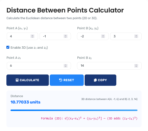
Yes, our calculator can handle 3D distance calculations when you provide coordinates in three dimensions (x, y, z). This is useful for architecture, engineering, physics, and any application where height/depth matters in addition to horizontal distance.
There's no practical maximum distance limit. The calculator can handle distances from microscopic scales to astronomical distances. However, for extremely large distances (like between planets), specialized calculators using different formulas may be more appropriate.
For approximate measurements without tools: Use known references (your stride is roughly 2.5 feet, your arm span is roughly your height), count steps, use time estimates (average walking speed is 3 mph), or use mobile apps with AR measurement features. For accurate measurements, physical tools or precise calculations are recommended.
Diagonal distances are important for: Cutting materials efficiently (avoiding waste), planning cable/wire routes (shortest path), calculating screen/viewing distances (optimal TV placement), determining actual travel distance on slopes, and solving geometry/trigonometry problems. Diagonal is often the most efficient straight-line path between non-aligned points.